|
The Campaign - World Heritage?
Clicking on a map will open a larger
version in a new page for closer examination.
Humane Society International has recently nominated the Exmouth
Gulf region, including the site of Straits' proposed massive salt
mine, for listing under the Australian Government's Australian Heritage
Database. The Government's Department of the Environment is now
processing the nomination under the stewardship of the Australian
Heritage Council.
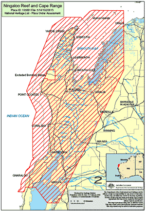
Figures 4, 5, 8-11&24: World Heritage Consultative
Committee (2005). Report on a proposal to nominate the North West
Cape — Ningaloo Reef area for inscription on the World Heritage
List. World Heritage Consultative Committee Final Report 18 October
2004. Government of Western Australia.
Full report available at:
http://www.naturebase.net/component/option,com_docman/task,doc_download/gid,399/Itemid,711/mode,view/
(5Mb pdf in new window)
Map 6: Department of Environment 2006, Pilbara
Coastal Water Quality Consultation Outcomes — Environmental
Values and Environmental Quality Objectives, Department of Environment,
Government of Western Australia, Marine Series Report No. 1. ISSN
1833-5470 30 March 2006.
Full report available at:
http://portal.environment.wa.gov.au/pls/portal/docs/PAGE/DOE_ADMIN/PROJECTS/TAB1142249/PILBARACOASTALWATERQUALITY_REPORT2.PDF
(3.8Mb pdf in new window)
|
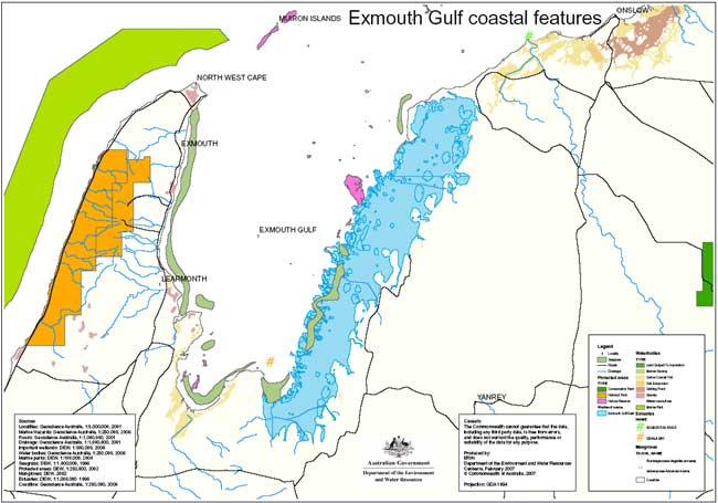 Map
sourced from the Wetlands of National Significance database
of the Federal Dept of Environment and Water Resources. Map
sourced from the Wetlands of National Significance database
of the Federal Dept of Environment and Water Resources.
The site comprises wetlands in the eastern part of Exmouth
Gulf, from Giralia Bay; to Urala Creek Locker Point, ie. it
includes marine waters less than 6 m deep at low tide, tidal
mudflats, and saline coastal salt flats 5-15 km wide (coloured
blue on map). Several islands subject to complete inundation
are included. Physical features: Landform: Megascale irregular-straight
coast within a larger embayment (Exmouth Gulf), with indentations
from numerous microscale-mesoscale channels (tidal creeks);
also adjoining irregular- elongate coastal (supratidal) plain,
6-10 km wide, with numerous indentations and islands of dry
land. Mudflats are typically 1 km wide but up to 4 km wide
in some places, e.g. Giralia Bay, and the mangroves are mostly
1 km wide. Geological setting: The coastal flats of marine
sediments are situated in the Carnarvon Basin; the inland
margin is defined by north-south trending sand dunes to 10
m high.
|
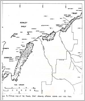
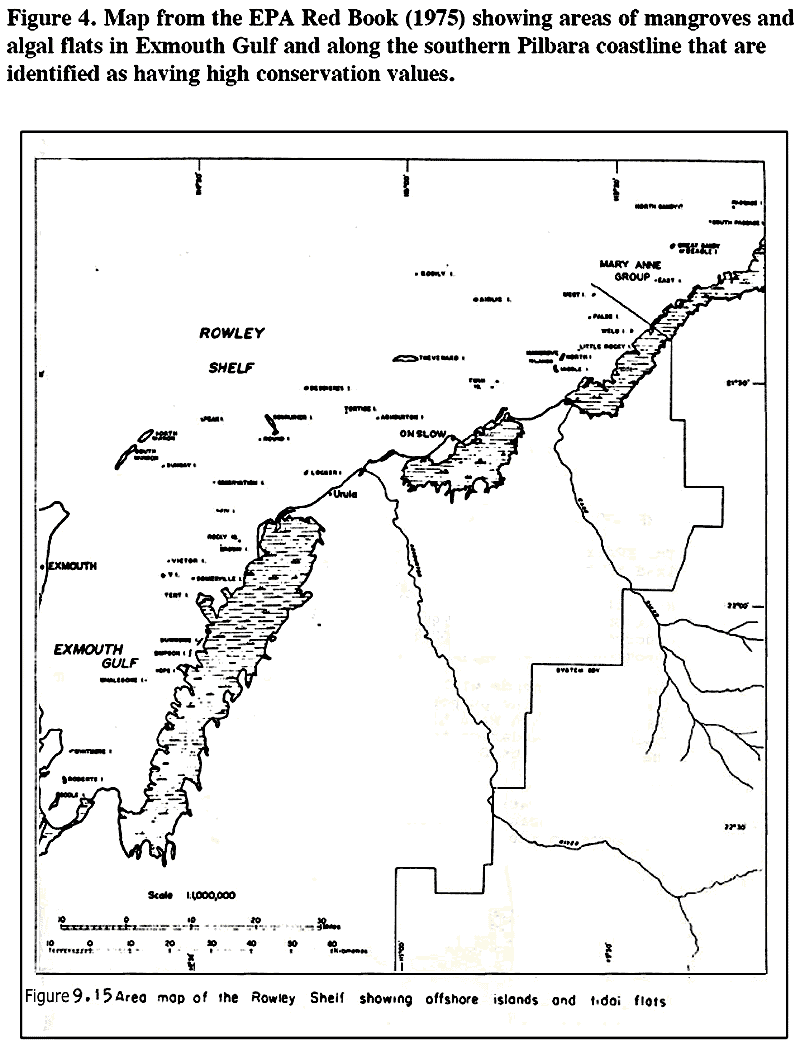
Figure 4. Map from the EPA Red Book (1975) showing areas of
mangroves and algal flats in Exmouth Gulf and along the southern
Pilbara coastline that are identified as having high conservation
values. (p23)
|
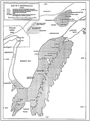
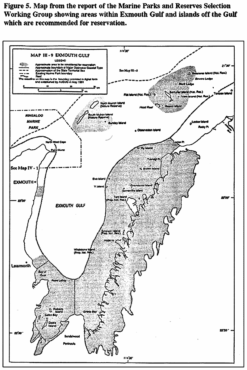
Figure 5. Map from the report of the Marine Parks and Reserves
Selection Working Group (1994) showing areas within Exmouth
Gulf and islands off the Gulf which are recommended for reservation.
(p26)
|
The following four maps demonstrate that the
entire area which will be impacted on by Straits Salts' proposals
satisfy all of the only four criteria for World Heritage Listing
under the Natural Heritage Property category for Listing (the
remaining six criteria deal with Cultural Property values).
For more information on Listing see attached
extract from the Committee's Report. |
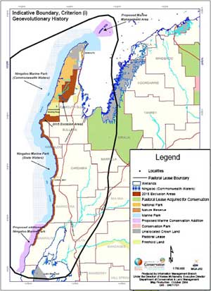
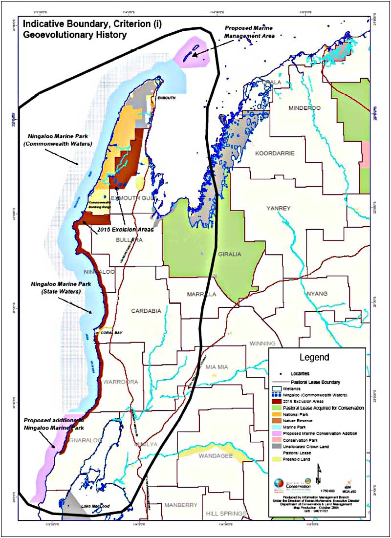
Figure 8. Indicative boundary for World Heritage Criterion
(i) Geoevolutionary history. (p41)
|
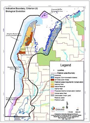
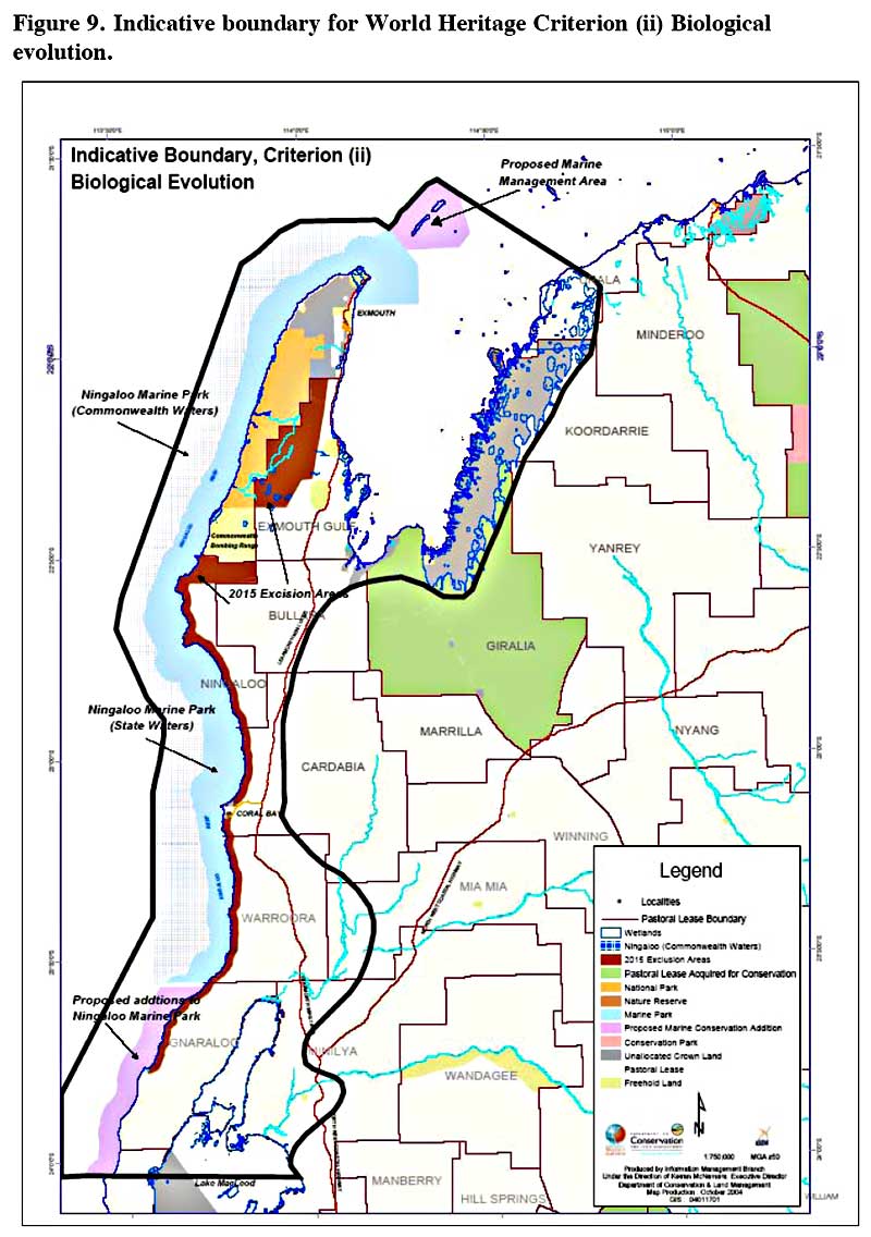
Figure 9. Indicative boundary for World Heritage Criterion
(ii) Biological evolution. (p42)
|
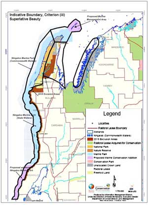
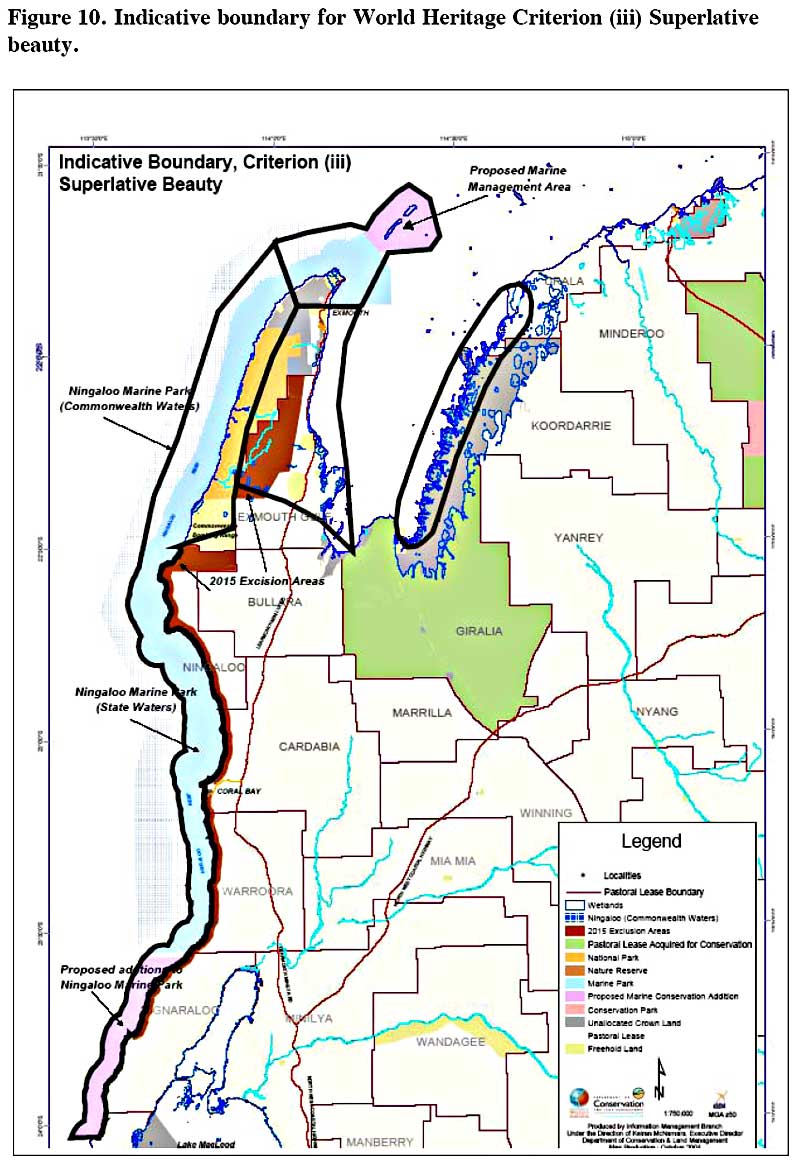
Figure 10. Indicative boundary for World Heritage Criterion
(iii) Superlative beauty. (p43)
|
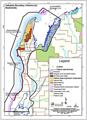
Figure 11. Indicative boundary for World Heritage Criterion
(iv) Biological diversity. (p44)
|
|
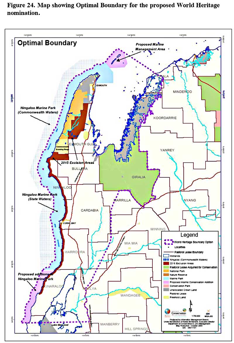
Note to map below: The Consultative Committee also offered
a further three optional boundaries for Listing pp 109-115
Report
on a proposal to nominate the North West Cape-Ningaloo Reef
area for inscription on the World Heritage List. World
Heritage Concultative Committee Final Report 18 October 2004.
(5Mb pdf in new window).
Each of these three optional boundaries also encompass the
entire area which will be impacted on by Straits Salts' proposals.
|
The map below demonstrates that the Environmental Protection
Authority's Environmental Quality Objective for nearly the
entire area that will be impacted on by Straits Salt is set
at 'Maximum' with the remainder (essentially the open waters
of the central and western Gulf) set at 'High'; again demonstrating
the extremely high values of the region. |
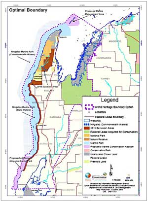
Figure 24. Map showing Optimal Boundary for the proposed
World Heritage nomination. (p110)
|
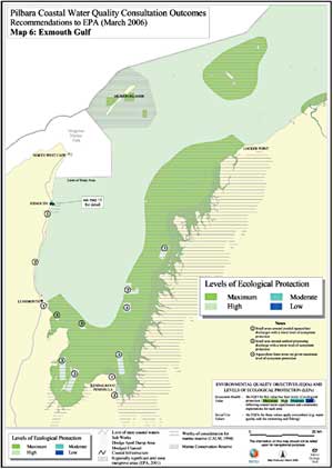
Map 6: Exmouth Gulf.
Pilbara Coastal Water Quality Consultation Outcomes Recommendations
to EPA (March 2006)
|
|